Clickable chart
Low Isles wind, weather and tides through the year
Answer in brief
Low Isles wind is lightest on November and December mornings and strongest from April to July, so September and October give the best mix of clear skies, easing wind and no stingers.
Weather facts
A year on the island
Sunrise, daylight and warmth at Low Isles
Choose a month to see sunrise, sunset and day length at Low Isles, with the usual warmth and what the island's own station records about rain, wind and cloud.
Sunset
Jan
January is hot, with a mean maximum of 32.2 °C on the island.29
Feb
February brings 452 mm of rain in the 1991 to 2020 average.25
Mar
March is the wettest month over the full record, 440.5 mm on average.3
Apr
April mornings are the windiest of the year, 26.5 km/h at 9am on average.1
May
The dry season begins around May.42
Jun
Humpback whales are met on the crossing from June to September.14
Jul
July is the coolest month, with a mean maximum of 25.5 °C.29
Aug
August averages 8.9 clear days at the island station.5
Sep
September is among the driest months, 37.3 mm of rain on average.3
Oct
October has the fewest cloudy days, 4.3 on average.28
Dec
December is the hottest month, with a mean maximum of 32.4 °C.29
Sunrise and sunset are worked out for the 15th of each month on Queensland time. Temperatures and rainfall in the chart are NOAA averages for the Low Isles Lighthouse station (0.1 km, on the island), 1991 to 2020; the notes quote the Bureau of Meteorology's own statistics for the same station.
Unlike most reef destinations, Low Isles keeps a Bureau weather station right beside its lighthouse, so the numbers here were measured on the island itself. Here is what the Low Isles wind, rain, cloud and tides do, month by month.
Editorial team, lowislestour.com · Updated November 8, 2026 · A 8 min read
A weather station on the island itself
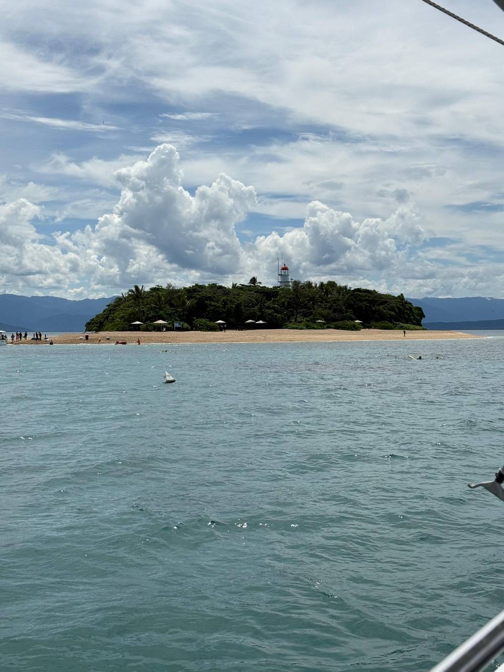
Most places borrow their weather from an airport miles away. Low Isles weather is measured on Low Isles. The Bureau of Meteorology's LOW ISLES LIGHTHOUSE station, site number 031037, began recording in 1887 and sits at an elevation of 3 m.7,8 According to Tourism Port Douglas Daintree, the island remains the Bureau's key forecasting point for this stretch of coast.9 When you walk past the small instrument enclosure near the lighthouse, you are looking at the source of the numbers on this page.10
You can check BOM Low Isles observations before you leave your hotel. The Bureau lists the station among its Queensland observations, with wind direction and speed, gusts, temperature and humidity updated through the day. Look at the morning reading and at the trend: a wind that is already strong at breakfast rarely drops by lunchtime. Quicksilver says it gets a Bureau weather update every morning and works with 3 day forecasts.11
The long record matters. Monthly averages built on decades of readings tell you what a month is usually like, which is what you need when booking weeks ahead. The live readings tell you what today is like, which is what you need the night before. Use both: book for the right season, then check the morning of your trip. The operators do the same, and they will tell you if the island itself is off limits on the day.12
Wind and sky
What the island station records
| Month | Wind 9am | Wind 3pm | Clear days | Rain |
|---|---|---|---|---|
| January | 17.1 km/h | 21.2 km/h | 3.0 | 401.2 mm |
| March | 22.4 km/h | 25.3 km/h | 2.3 | 440.5 mm |
| April | 26.5 km/h | 29.0 km/h | 2.8 | 229.0 mm |
| July | 25.5 km/h | 28.6 km/h | 7.7 | 36.9 mm |
| September | 21.0 km/h | 23.9 km/h | 8.5 | 37.3 mm |
| October | 18.6 km/h | 22.6 km/h | 8.9 | 45.6 mm |
| November | 15.6 km/h | 21.0 km/h | 6.3 | 88.1 mm |
Averages per month from the Low Isles Lighthouse station of the Bureau of Meteorology; clear days 1967 to 2010, rainfall over the full record from 1887.1,2,6,3
Low Isles wind through the year
Low Isles wind follows the trade winds. At 9am the Bureau's mean wind speed on the island runs from 15.6 km/h in November and 15.7 km/h in December up to 26.5 km/h in April.1 The afternoon is windier in every month, with 3pm means of 29.0 km/h in April and May.2 The daily wind run tells the same story: an average of 682 km of air passes the station each day in April, against 460 km in December.16
Tourism Australia describes the same pattern for the region. The rain eases from April, the weather can stay windy until August, and south-easterly winds prevail until around October.14 On Low Isles, the windy months are also the dry ones, which is the trade-off of the dry season: clearer skies, less rain, more breeze. From June to August the 9am mean stays between 23.0 and 25.6 km/h.1
The calm comes at the turn of the year. September eases to 21.0 km/h at 9am and October to 18.6 km/h, before November and December bring the lightest mornings of the year.1 Gusts are another matter: the highest gust recorded at the station is 158 km/h in February, the heart of the cyclone season.17 The averages hide the storms, so treat a summer forecast with respect even when the mean looks gentle.
Rain and warmth
Low Isles month by month
- Jan11.0 h
- Feb11.4 h
- Mar11.8 h
- Apr12.3 h
- May12.6 h
- Jun12.8 h
- Jul12.8 h
- Aug12.5 h
- Sep12.0 h
- Oct11.6 h
- Nov11.1 h
- Dec10.9 h
Mid-month hours with no sun, and days when precipitation reaches 2.5 mm or above. Source: NOAA, station Low Isles Lighthouse, 1991 to 2020.4
What the wind means on the boat and in the lagoon
Wind changes the trip in three ways. It shapes the crossing, it stirs the water you snorkel in, and on the sailing boats it decides whether the sails go up. Sailaway says its Low Isles trips are pure sailing when there is enough wind, which makes a breezy dry-season day a good one for a sailing catamaran.18 Calypso's Low Isles boat is a wide-bodied catamaran built for stability.19 On a breezy morning, sit low and close to the centre line of the hull, where it rocks least.
For the swim, lighter wind usually means flatter water in the lagoon, and Quicksilver links the lower clarity of inshore reefs to fine sediment in the water.20 Mornings are calmer than afternoons in every month of the Bureau's record, so an early departure is the safer bet for snorkelers.1,2 If you are prone to seasickness, Quicksilver offers free ginger tablets on Wavedancer and says motion medication works best taken on boarding.21
Bad weather does not usually cancel the day, but it can change it. Calypso warns that in some conditions landing on the island may not be possible.12 Quicksilver says that if a cruise does not run, you are offered another day or a refund.22 Free cancellation on the trip sold here runs until 24 hours before departure, long enough to see how the forecast settles; Sailaway also works to a 24-hour window.23
Pick your month
Match the month to what matters to you
Choose the line that matters most and the months that fit it best.
If I want the calmest water
November or December mornings
The 9am mean wind is at its lowest then.1
If I want clear skies for photos
August to October
The station averages up to 8.9 clear days a month.6
If I want to avoid stingers
May to October
The higher-risk season runs November to May.13
If I want a real sail
April to August
If I want to see whales
June to September
Boats to Low Isles regularly meet humpbacks then.15
Rain, the wet season and cyclones
The wet season is wet. Over the station's full record the mean rainfall peaks at 440.5 mm in March, follows 413.7 mm in February and 401.2 mm in January, and falls to 36.9 mm in July and 37.3 mm in September.3 The station averages 2115.3 mm a year.3 Rain days follow the same curve, from 20.0 days in March to 7.7 in October.25 NOAA's 1991 to 2020 summary for the same station puts February at 452 mm.4
Rain alone rarely stops the boats. Calypso says it does not cancel tours for rain, which falls mainly in the summer months and does not spoil the reef.26 A tropical downpour on the lagoon can even be beautiful, and the water stays warm. What matters more is the wind, plus the sediment and nutrients that an inshore reef has to cope with.20 After a big summer downpour, a day or two of settled weather often gives the lagoon a chance to clear before you swim.
Cyclones are the real summer risk. The Bureau's official cyclone season for Australian waters lasts from 1 November to 30 April.5 Quicksilver says cancellations are very rare but that a seasonal cyclone would stop its operation.27 If you travel in those months, book a flexible ticket, leave a buffer day in your itinerary and watch the Bureau's warnings rather than the beach outside your window.
A year of weather
The Low Isles seasons in order
Sun, cloud, heat and humidity
The clearest skies come late in the dry season. The station averages 8.9 clear days in August and in October, and 8.5 in September, against just 1.6 in February.6 Cloudy days drop from 14.7 in February and March to 4.3 in October.28 For photographs of the turquoise lagoon and for the best light underwater, those spring months are hard to beat. Summer brings big, dramatic cloudscapes instead, which photograph well from the boat but take the sparkle off the water.
It is warm all year. The mean maximum on the island ranges from 25.5 °C in July to 32.4 °C in December.29 Afternoon humidity is lowest in September and October, at 63 per cent, and highest from February to May at 74 per cent.30 Summer feels sticky on the boat; winter feels pleasant in the sun and cool in the breeze, so pack a light layer for the crossing whatever the month. A dry shirt for the trip home is a small luxury after a long swim.
Queensland does not use daylight saving, so the clock stays on UTC +10 all year.31 The sun is strong even on cloudy days. Tourism Australia's advice applies on the island too: SPF30+ sunscreen, sun-smart clothing, a hat and sunglasses.32 A lycra suit does double duty, covering you against sunburn as well as stings.33 Reapply sunscreen to your face, ears and the back of your neck after every swim, because those are the parts that stay above the water while you snorkel.
Video
When to visit the Great Barrier Reef
HAFID TOURS AND TRAVEL on YouTube · Playback files load only once you tap play.
Weather data has also been gathered from the island since 1887, and still today remains the region’s primary point of weather forecasting through the Bureau of Meteorology.
The day before
Your weather check for a Low Isles trip
Check online3
Plan the day3
- Choose a morning departure on a windy forecast1
- Keep free cancellation in mind: 24 hours on this trip
- Pack a light layer for the crossing
Tides and the lagoon
People often look for tide times for Low Isles. The Bureau of Meteorology publishes official tide predictions for Port Douglas, the nearest standard location to the island.24 Check them a few days ahead and again the evening before. The operators already plan around them: Calypso says its timings are an approximate guide that can shift with tide times and other factors.34 If your booking time moves by a little, that is usually the reason.
Tide changes the lagoon more than the beach. The snorkeling depth is given as 0 to 5 metres, so on a very low tide the shallowest coral heads come close to the surface and you need to float carefully over them.35 At higher tides there is more water above the reef and swimming is easier for beginners. The tide also changes the walk: back on the mainland, Four Mile Beach can be over 100 metres wide at low tide.36
The island's scientists took tides seriously from the start. The expedition that lived here from 1928 brought an automatic tide gauge along with its thermograph, barograph and anemometer.37,38 You do not need one. Ask the crew how the tide will run during your island time, snorkel the deeper edges when the water is low, and never stand on coral that is close to the surface. A low tide is also a good time for the beach walk, when the reef flat shows its rubble, pools and small creatures.
Stingers, water temperature and the best months
The water itself is warm all year. In summer the sea off the beaches north of Cairns averages 28.9 to 29.4 °C, according to Tourism Australia, and Quicksilver quotes 22 to 29 Celsius across the region.39,40 The catch in the warm months is jellyfish: the state government flags November to May as the higher-risk months for stingers, and it advises a full-body lycra suit.13,41 The boats hand out suits, so the warm season costs you nothing more than a few minutes of wriggling into one.
Port Douglas has two seasons. Tourism Australia describes a dry season from around May to around October, and a hot season with occasional storms from November to April.42 It names May to October as the window for the clearest water on Port Douglas reef trips.43 Add the humpback whales, met on the crossing from June to September, and the dry season has a lot going for it.15 It is also the busiest time in Port Douglas, so book a little ahead.
Put the numbers together and September and October stand out. The rain is near its lowest, clear days near their highest, the morning wind is falling from its autumn peak, and the stinger season has not yet begun.3,6,1,13 November and December offer the calmest mornings of all but bring stingers, rising heat and the start of the cyclone season.1,5 No month is a write-off; each simply asks for a different plan.
FAQ
The short answers to your questions.
Where does Low Isles weather data come from?
The Bureau's Low Isles Lighthouse station, site 031037, has recorded since 1887.7
When is the wind lightest at Low Isles?
The 9am mean is 15.6 km/h in November and 15.7 km/h in December.1
When is the wind strongest?
The 3pm mean reaches 29.0 km/h in April and May.2
Do tours get cancelled for rain?
Where do I find tide times?
The Bureau publishes official predictions for Port Douglas.24
Which months are clearest?
The station averages 8.9 clear days in August and October.6
Is there daylight saving?
Queensland stays on UTC +10 all year.31
Sources
- Bureau of Meteorology · Climate statistics for Australian locations: Low Isles Lighthouse ↩
- Bureau of Meteorology · Climate statistics for Australian locations: Low Isles Lighthouse ↩
- Bureau of Meteorology · Climate statistics for Australian locations: Low Isles Lighthouse ↩
- NOAA · Global Summary of the Month, Station Low Isles Lighthouse (NOAA GHCN ASN00031037), 1991 to 2020 ↩
- Bureau of Meteorology · Australian tropical cyclone season ↩
- Bureau of Meteorology · Climate statistics for Australian locations: Low Isles Lighthouse ↩
- Bureau of Meteorology · Climate statistics for Australian locations: Low Isles Lighthouse ↩
- Bureau of Meteorology · Climate statistics for Australian locations: Low Isles Lighthouse ↩
- Tourism Port Douglas Daintree · Low Isles ↩
- Calypso Reef Cruises · Low Isles half day tour ↩
- Quicksilver Wavedancer · Low Isles tour FAQ ↩
- Calypso Reef Cruises · Low Isles half day tour ↩
- Queensland Government · Dangerous marine animals ↩
- Tourism Australia · Cairns weather ↩
- Low Isles Preservation Society · Whale season ↩
- Bureau of Meteorology · Climate statistics for Australian locations: Low Isles Lighthouse ↩
- Bureau of Meteorology · Climate statistics for Australian locations: Low Isles Lighthouse ↩
- Sailaway Port Douglas · FAQs ↩
- Calypso Reef Cruises · Low Isles half day tour ↩
- Quicksilver Wavedancer · About Low Isles ↩
- Quicksilver Wavedancer · Low Isles tour FAQ ↩
- Quicksilver Wavedancer · Low Isles tour FAQ ↩
- Sailaway Port Douglas · FAQs ↩
- Bureau of Meteorology · Tide Predictions for Australia, South Pacific and Antarctica ↩
- Bureau of Meteorology · Climate statistics for Australian locations: Low Isles Lighthouse ↩
- Calypso Reef Cruises · Low Isles half day tour ↩
- Quicksilver Wavedancer · Low Isles tour FAQ ↩
- Bureau of Meteorology · Climate statistics for Australian locations: Low Isles Lighthouse ↩
- Bureau of Meteorology · Climate statistics for Australian locations: Low Isles Lighthouse ↩
- Bureau of Meteorology · Climate statistics for Australian locations: Low Isles Lighthouse ↩
- Tourism Australia · Cairns weather ↩
- Tourism Australia · Cairns weather ↩
- Great Barrier Reef Marine Park Authority · Responsible reef practices ↩
- Calypso Reef Cruises · Low Isles half day tour ↩
- Quicksilver Wavedancer · Low Isles tour FAQ ↩
- Tourism Port Douglas Daintree · Port Douglas ↩
- Low Isles Preservation Society · The 1928-29 Great Barrier Reef Expedition ↩
- Low Isles Preservation Society · The 1928-29 Great Barrier Reef Expedition ↩
- Tourism Australia · Cairns weather ↩
- Quicksilver Wavedancer · Low Isles tour FAQ ↩
- Queensland Government · Dangerous marine animals ↩
- Tourism Australia · Guide to Port Douglas ↩
- Tourism Australia · Guide to Port Douglas ↩
Continue reading