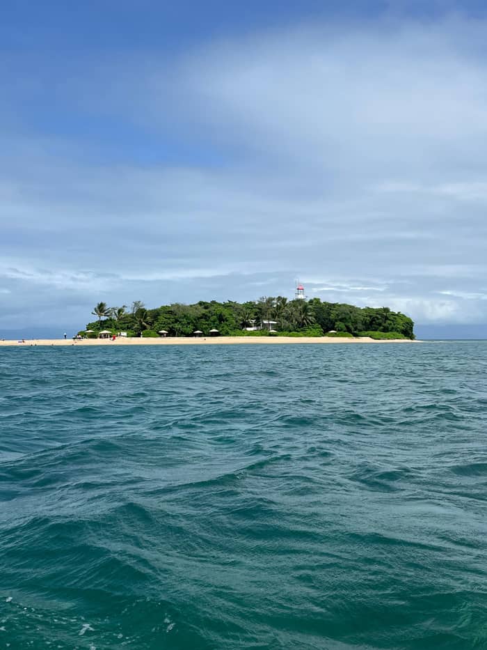
Like Low Island
Coral cay
Built from reef sand
- Made ofRubble and sand
- HeightJust above the tide
- On the reefAbout 300
Guides
Language
Currency
Check datesstarting at $173 · free cancellationHelp me decide
Answer in brief
Low islands are made from coral rubble and sand that waves and tides pile onto a reef flat, and they turn green when birds, wind and currents bring seeds.
How it formed
Two taps to your island day
Say how you like to learn and how much of the day you can give, and a matching listing appears with its from-price.
Recommended for you
from $173
It lasts 4 hours with 1.5 hours at the island and is rated 4.67 from 521 reviews.
Recommended for you
from $194
A marine biologist talk and a guided beach walk; rated 4.71 from 232 reviews.
Recommended for you
from $256
It moors in the lagoon for 4.5 hours with a heritage walk; rated 4.82 from 104 reviews.
Recommended for you
from $256
3 hours in the lagoon, then a sunset sail home; rated 4.76 from 101 reviews.
Low Isles is a textbook low island: a heap of reef sand and rubble with trees on top, beside a mangrove island on the same reef. Here is how it formed, how big it is and why scientists chose it.
Editorial team, lowislestour.com · Updated November 8, 2026 · A 8 min read
Main facts
Ask what low islands are made from and the answer at Low Isles is simple: the reef itself. The Australian Institute of Marine Science explains that sand cays form when wave and tidal action pile coral rubble and sand onto reef flats.1 Broken coral, shell, the skeletons of tiny reef animals and the sand that parrotfish grind out of coral all end up in the heap. Over time the pile rises above the high tide line and stays there.
That makes a low island very different from the hilly islands you see along the coast. The Reef Authority counts about 300 coral cays on the Great Barrier Reef, against 600 continental islands and about 150 inshore mangrove islands.6 Continental islands are the tops of old hills and mountains, made of mainland rock. Coral cays are built from the reef and rise only a little above the sea, and the name Low Isles describes exactly that.
Low Island is one of these coral cays. The Reef Authority calls it a sandy coral cay and pairs it with Woody Island, an uninhabited island of coral and mangroves; together the two small islands form the Low Isles.2 Quicksilver calls Low Island a vegetated coral cay.7 Captain Cook's 1770 description, a small low island, still fits it well.8 Stand on the beach and look down: you are standing on the remains of the reef you are about to swim over.
Side by side
| Feature | Low Island | Woody Island |
|---|---|---|
| Type | Sandy coral cay2 | Coral and mangrove island2 |
| Size | The smaller of the pair4 | The larger of the pair4 |
| People | Caretakers and visitors17 | Uninhabited2 |
| Wildlife | Osprey on the lighthouse18 | Pigeon breeding colony19 |
| Visiting | Day trips land here20 | Seen from the beach |
Drawn from the Reef Authority, the island's volunteer society and operator pages; both islands sit on one reef.2,4,21
The story starts with the sea rising. The marine science institute says sea level has risen about 120 metres in the last 20,000 years.9 As the coastal plain flooded, its small hills became places where waves broke and corals grew best. The inner reefs, AIMS explains, are mostly the tops of those hills, once ringed by fringing reefs and later covered entirely by coral as the water rose.10
Once a reef reaches the surface, the waves start building. Sand cays are more frequent on the inner reefs, where waves and currents are gentler than further out, and they rarely form on the outer reefs because the wave action is too strong.13,14 Cays usually build up on the sheltered, leeward side of a reef, where the water drops its load of sand.11 That is the whole recipe for how low islands are formed: a shallow reef, a steady supply of broken coral, and waves that pile it in one place.
Then life moves in. Birds, wind and currents carry seeds to a new cay, and with time it becomes vegetated.12 At Low Isles the birds are a big part of that delivery service: when researchers studied pied imperial pigeon droppings here from December 1994 to April 1995, they recorded 68 plant species over four months.15 Roots hold the sand, leaf litter becomes soil, and a bare sandbank slowly turns into a wooded island.
Low Isles is really a pair. James Cook University's history of the reef expedition describes two separate islands sharing a common coral reef foundation: the smaller, oval coral cay is Low Island, and the larger island, Woody Island, is mainly coral and mangroves.22 Tourism Port Douglas Daintree says the two islands sit within 55 acres of reef that they share.21 From the beach you can see Woody Island's dark green line across the water.
The Low Isles Preservation Society calls the site an inner patch reef with a small coral cay and a larger mangrove island, and says that combination is unique on the Great Barrier Reef.4,23 The reef's hook-like shape encloses the sheltered lagoon where turtles feed and where the boats anchor.23 Without that curve, the lagoon would be open water and the day trip would be a very different, choppier outing.
The two islands play different roles. Low Island is the sandy cay with the lighthouse, the paths and the beach where visitors land. Woody Island is a mangrove island that Quicksilver describes as a nursery for juvenile fish and crustaceans, and that thousands of pigeons use as a breeding colony each season.24,19 You visit one; you look at the other. Both depend on the same reef, and both would change if it did. That is worth remembering when the guide points across the water: the dark line of trees is as much a part of the reef as the coral under your mask.
Island types
Like Low Island
Built from reef sand
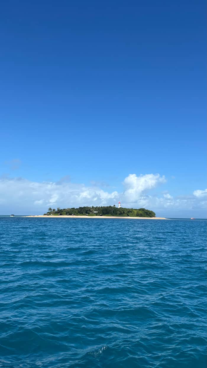
Like Woody Island
Roots in the shallows
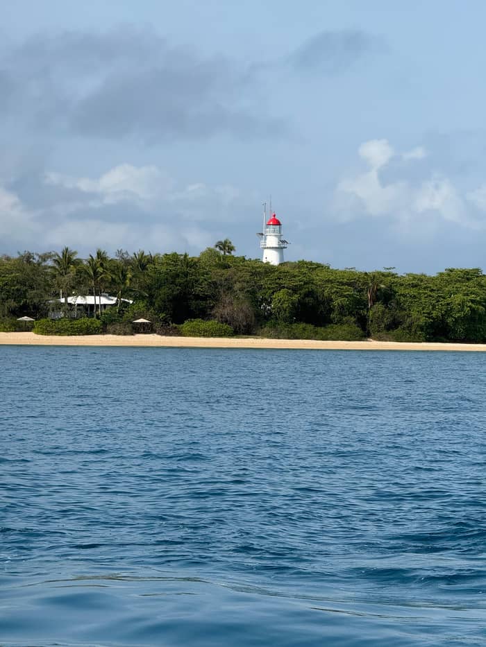
High and rocky
An old drowned hill
How big Low Isles is depends on whom you ask and when. Quicksilver gives the cay as 4 acres, set in 55 acres of reef, 15 km north-east of Port Douglas.3 The Low Isles Preservation Society, writing about the 1928 expedition, says the island was then about three acres and is now about one acre because of erosion.16 The two sources measure different things at different times, so treat them as a range, not one exact figure.
What everyone agrees on is that it is small. Tourism Port Douglas Daintree reckons a stroll around the whole island takes about 15 minutes.27 It is also low: the Bureau of Meteorology station beside the lighthouse sits at an elevation of 3 m.26 A storm surge or a run of big tides is a serious matter on an island like this, and the edges of the cay are never quite the same from one year to the next. Watch for the line of washed-up rubble and seaweed that marks the last big tide.
The reef around it is far larger than the land. Calypso puts the surrounding coral at roughly 55 acres and notes that the shipping channel cuts Low Isles off from the main reef system.28 Across the wider region, the Reef Authority gives the inshore waters an average depth of 35 metres.29 At Low Isles the snorkeling area is far shallower than that, which is exactly what you would expect on top of an old hill. The shallow water is the reef flat the cay grew from, and it is the reason the lagoon feels so calm on a light-wind day.
From hill to island
Ice age
Sea level is about 120 metres lower than now.9
Sea rises
Corals grow on drowned hills and cover them.10
Waves work
Rubble and sand build up on the reef flat.1
Sheltered side
Cays usually form on the leeward side.11
Seeds arrive
Birds, wind and currents carry seeds in.12
A coral cay is not fixed. Sand moves with the waves, and the beach you walk on may sit a little differently next year. The clearest sign at Low Isles is human: coastal erosion threatened the grave of Jane Ann Owen, the first keeper's wife, and her remains were exhumed and respectfully reburied in 2023 and 2024.30 The island's own history is being reshaped by the same forces that built it.
Storms and floods do the rest. Quicksilver points out that inshore reefs take in more nutrients and fine sediment, and see less clear water, than reefs offshore, and that cyclones and floods can reshape them.31 The island's birds show how sharp those shifts can be: after Cyclone Jasper, only 151 pigeons were counted in February 2024, a fraction of the roughly 18,000 seen at the 2022-23 peak.32
People have changed it too. Yonge's own verdict on his 1978 return was bleak: the once-rich reef surface was almost entirely dead, and he blamed silt washed down the Daintree River once the rainforest was cleared.33 A 2018 survey found the shallow reef flat dominated by soft corals and algae instead of hard coral.34 A low island depends on a living reef to keep supplying sand, which is why its stewards watch the water as closely as the land.
Video
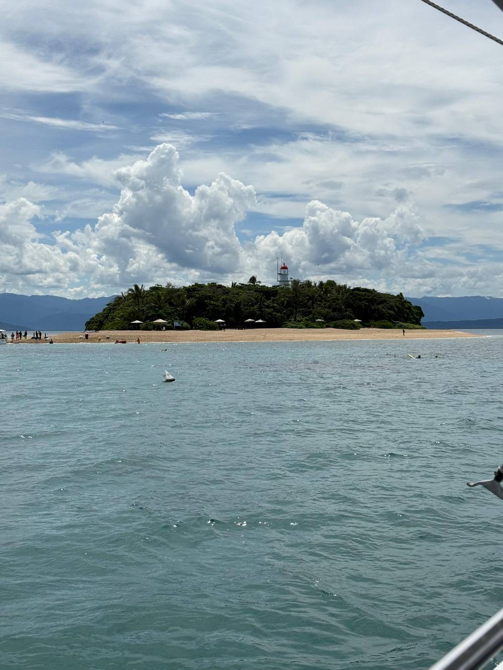
CuriosityShow on YouTube · Playback files load only once you tap play.
Sand Cays are formed when wave and tidal action deposit coral rubble and sand onto reef flats.
On the island
Low Isles was chosen for science because of its geology. The James Cook University history says it made an ideal base: an island built entirely of coral, ringed by a broad reef that gave boats an excellent harbor.35 On July 16, 1928, twelve scientists arrived to begin thirteen months of research, and at the peak there were 23 scientists on the island.36,37 The Reef Authority calls it the first scientific study on the Great Barrier Reef.5
They were young and new to coral. The university's history says none of the ten core members who sailed from England had ever seen a coral reef, most were under 30, and their leader, Yonge, was 27.38,39 They brought a thermograph, a barograph, a sunshine recorder, an anemometer, an automatic tide gauge and a Secchi disc to measure water clarity.40 They left on July 28, 1929, after a year and a few weeks on the cay.41
The results filled seven volumes, covering coral physiology, bleaching, tides, water chemistry and transect surveys.42 One finding was decades ahead of its time: the team recorded corals bleaching after a rise of 1 °C and dying at 2 °C above normal.43 Low Isles remains one of six island research stations on the reef today.44 When you walk the beach, you walk where modern coral reef science began.
Long before the geologists, the island had a name. The Low Isles Preservation Society says the islands are known as Wungkun, and that the sea country of the Kuku Yalanji and Yirrganydji peoples overlaps here.45 The society also records that it has long been seen as a peace island, where disputes were settled.46 The Reef Authority says both peoples hold the island in their dreamings.47
That significance is part of the island's protection. Since 2008 the island has been on the Commonwealth Heritage List, recognised for Indigenous and historic values alike.48 It also lies inside the Marine National Park Zone of the Marine Park, among the most strongly protected zones in the park.49 The stories that belong to Traditional Owners are theirs to tell; the museum on the island and guided walks are the places to hear what they choose to share.
Knowing all this changes how the island looks. The beach is not just sand but ground-up reef; the trees came as seeds on birds and currents; the lagoon exists because of a hook of coral; and people have met here for far longer than the lighthouse has stood. A short walk around Low Island is a walk through geology, ecology and history at once, and it costs nothing more than the time between swims.
FAQ
Waves and tides pile coral rubble and sand onto a reef flat until it rises above the sea.1
The Reef Authority calls it an uninhabited coral and mangrove island.2
The island society says it was about three acres in 1928 and about one acre now.16
It was a purely coral island ringed by a large reef that made an excellent harbour.35
Their sea country overlaps at Low Isles, known as Wungkun.45
Sources
Continue reading
Choosing a Low Isles boat? Ask a real person here.